
Mexico covers 1.96 million square kilometers (about 757,000 square miles), making it the 13th-largest country in the world. It once stretched over a far greater area and included six modern U.S. states, including the vast forests, mountains and deserts of California. To understand how Mexico occupied the West Coast of North America, we need to understand the geography of the continent.
The Atlantic coastline of what is now the United States was colonized by Britain and seemed to offer little other than farmland. In the southern half of the continent, the Amazon restricted colonization to the coast. European expansion, led by the Spanish, therefore funneled through the Caribbean Islands, where the climate was suited for plantations, and into Central America, where there was the promise of gold and other riches. Mexico — or “New Spain” as it was known for three centuries — was not only a vast country, but the center of a great Spanish empire that at its height stretched for some 11,000 kilometers (about 6,800 miles) from the tip of Argentina almost to the edge of Alaska.
Spanish shipbuilding in Mexico
Cortés brought down the Mexica empire in 1521, and although Spanish exploration did not stop, it slowed down. One problem was the lack of ships on the Pacific coast, for rounding Cape Horn was a dangerous venture for any captain. However, once the Spanish were established in Central America, ships could be dismantled, hauled across the isthmus, and reassembled. The establishment of the shipyards required for such work first centered on the Gulf of San Miguel in modern Panama, where it was just 60 kilometers (about 37 miles) from the Atlantic to the Pacific. The initial driving force for such activity was not the old dream of exploration, but the need to transport enslaved peoples from Central America to the new mines opening up in Peru.
Such ships were generally caravels, 40 to 75 feet in length and weighing between 50 and 160 tons. Their small size and frame-first design meant a ship could be assembled in three to nine months, and within a decade, modest shipbuilding enterprises had sprung up in numerous places along the coast. These included Acapulco, where Hernán Cortés encouraged the industry with the building of a wharf and the marking out of a rough road to Mexico City.
Explorations of California
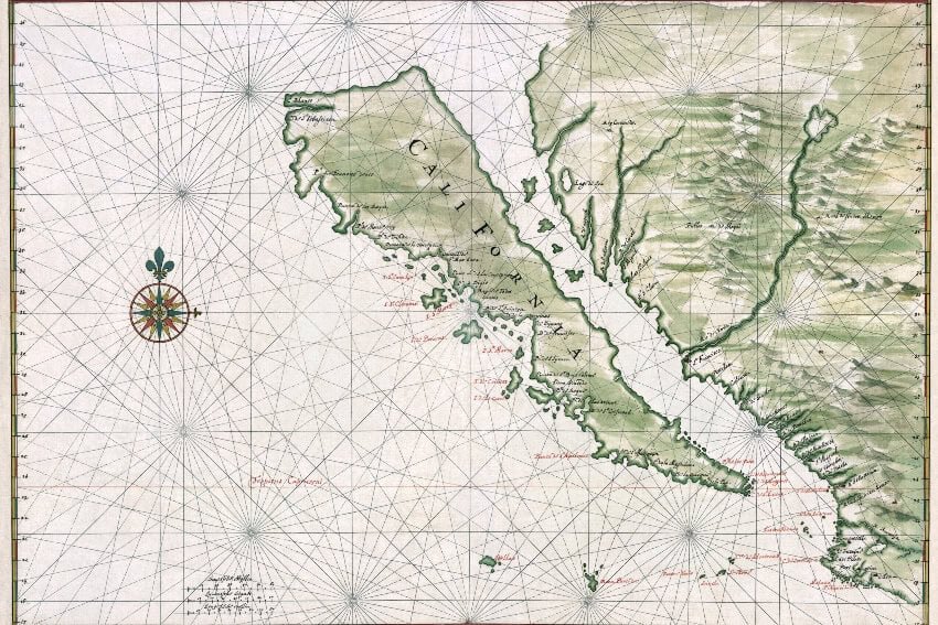
Not that exploration stopped altogether, and as early as 1533, Hernán Cortés sent a small party to investigate California, whose name came from a 1510 Spanish romance novel by Garci Rodríguez de Montalvo, “Las Sergas de Esplandián.” They did not find that elusive route to China, nor the rumored “seven cities of gold,” but Fortún Jiménez became the first European to set foot on Baja California.
Cortés himself arrived in what is now La Paz in May 1535. He believed Baja to be an island, which he claimed for Spain. There was no gold, but there were pearl beds, and a small colony was founded. However, the terrain and climate proved too harsh, and this first settlement was abandoned. In 1539, Francisco de Ulloa sailed north on a new mission of exploration, and he discovered that Baja was not an island but a peninsula. The letter he sent back to Acapulco did not encourage others to follow. The land, he declared, was “ugly and barren, as poor here as it was in parts seen earlier.”
The Manila-Acapulco galleon trade
Shipbuilding was making great strides on the Pacific coast, and by 1542, two expeditions could be dispatched. Ruy López de Villalobos sailed with six Guatemalan-built ships to head for the Philippines, while Juan Rodríguez Cabrillo sailed with three ships to explore the “uncharted waters of the north.” The Cabrillo fleet sailed past Baja to California proper, perhaps reaching as far as the mouth of the Russian River that lies well north of modern San Francisco. Cabrillo did not survive the journey. He slipped on some rocks and shattered his shin, a wound that became infected with gangrene. He died on Jan. 3, 1543.

A few concessions were handed out for the exploitation of the pearl beds within the Gulf of California, and there were souls to be saved, which motivated the opening of a handful of small missions in the southern half of the peninsula. However, little interest was shown in the lands beyond the peninsula. What drew the Spanish back to these waters was the opening of the trade route with the Philippines.
Why the galleons sailed down the California Coast
This had taken time to establish, for while sailing to the Philippines was a harsh journey, it was also relatively straightforward. Winds and currents made the return journey far more complex, and it was 1565 before the Spanish discovered that by sailing north to around 40 degrees of latitude, a ship could pick up the westerly trade winds and benefit from the powerful Kuroshio Current. Even if all went well, reaching the American coast could take months, and ships would strike land far to the north. Returning galleons now sailed down the California coast each year, and no doubt knowledge of this unexplored world was passed on by word of mouth, but we have no record of such conversations.
Pirates and explorers
Another wanderer along the Pacific coast was not Spanish but the English hero — or pirate, depending on your point of view — Francis Drake. He left Plymouth in 1577 and reached the Strait of Magellan in September 1578. He headed into this strait with six ships, but only the Golden Hind survived the notorious storms that ravaged these waters. After terrorizing the Spanish coast, he sailed north beyond Spanish reach, where he stopped to repair his ship and claim the land for England. His precise landing point is uncertain, but it would have been north of modern San Francisco. From here, Drake headed out into the Pacific to complete the first circumnavigation of the globe in 58 years.
There was another motivation for exploring along the California coast: the search for the Strait of Anian. This northern passage to the Atlantic started to appear on maps from around 1560, but its existence had never been confirmed. In 1584, Franciscus Gaill continued the exploration of the Pacific coast, describing California in promising terms and noting the abundance of seals. The record of his journey might have been lost to us except that an account somehow found its way into the travel journals of the Dutch explorer Jan Huygen.
Cavendish and the taking of the Manila galleon
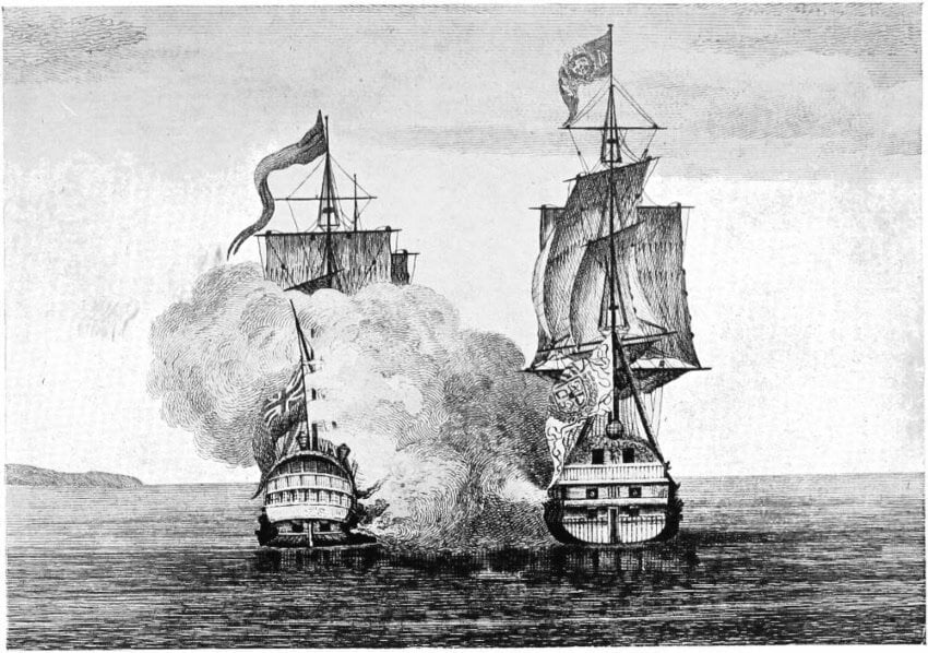
The English had not gone away, and in 1587 the privateer Thomas Cavendish lurked off the coast of Baja California, where he seized and burned the Manila galleon Santa Ana. The crew was put ashore with supplies and survived, with two of the officers, Vizcaíno and Cermeño, going on to become important explorers of this coast. In 1595, Sebastián Rodríguez Cermeño commanded the Manila galleon San Agustín with orders to explore the California coastline on the return journey. He was anchored in a small bay when they were hit by a storm that sank his great ship. Cermeño and his crew struggled home in a small boat, but the loss of the Manila galleon must have been a devastating blow to the Spanish economy that year.
A search for a safe harbor
This loss demonstrated the need for a safe harbor along the Northern coast, and in 1601, the search was entrusted to Sebastián Vizcaíno. He was well acquainted with these waters, having sailed on the Manila galleons himself and having also operated pearl concessions from La Paz. Vizcaíno mapped the California coastline as far north as Monterey without finding a suitable harbor. He felt Monterey Bay was unsuitable as it was exposed to rough currents and winds, and he missed San Francisco Bay completely, most likely passing when it was shrouded in mist.
There was no obvious harbor, little promise from the land and the British threat seemed to have passed. Spanish interest faded with the world beyond the Baja California peninsula, and ships returning from the Philippines were left to find shelter and take on water where they could. This period of apathy would last a century and a half.
José de Gálvez and the founding of new missions in California
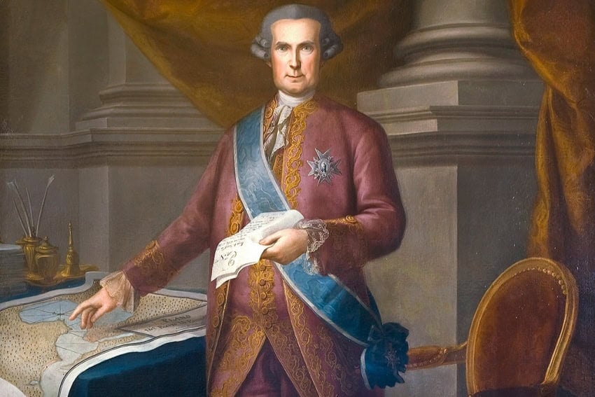
In 1765, José de Gálvez arrived in New Spain as the king’s special deputy. The Spanish government was bankrupt after the Seven Years’ War, and New Spain would have to refill the royal coffers. The ambitious Gálvez imposed state monopolies and introduced new taxes. Playing on fears that the British, Dutch or even the Russians had ambitions for the northern Pacific coast, he prepared a grand expedition that would not just explore, but would colonize the north.
Don Gaspar de Portolá, a Spanish Army officer from minor Catalan nobility, was given command of the land expedition, and with him would be the remarkable Father Junípero Serra. He was a member of the Franciscan Order and, on arriving in New Spain in 1749, had refused the offer of a horse and walked to Mexico City. He arrived with his left foot swollen and infected, a painful condition that remained with him the rest of his life.
The journey of Serra and Portolá
Gaspar de Portolá’s overland party reached the site of present-day San Diego in July 1769 to find that the two galleons carrying their supplies had only just arrived. They had missed the bay and sailed lost for several weeks, during which time the crews were devastated by scurvy. The initial force of 300 men was down to half that number, but Portolá continued northward with 63 soldiers and 100 mules. Moving painfully slowly, they arrived in what is now Los Angeles in early August. Early November saw them cross a low coastal mountain range and look down on San Francisco Bay, the perfect harbor that the Spanish had been seeking for so long.
Back in San Diego, Father Serra built a small hut to act as a church, and this would grow into the Mission San Diego. During the early years, this and the other missions that followed would be dependent on supply ships arriving from Mexico, but a local economy was slowly established, based around raising cattle.
California (California and Baja California weren’t formally recognized as separate territories until 1804), however, remained a neglected outpost of a faltering Spanish empire, with the Spanish population never rising above 14,000. Within three decades, Lewis and Clark would complete the first east-to-west crossing of the northern half of the continent, bringing the Pacific Coast within the sights of the small but ambitious and rapidly expanding United States of America.
Bob Pateman lived in Mexico for six years. He is a librarian and teacher with a Master’s Degree in History.
