
As part of an exploration into Mexico’s long and rich history, Mexico News Daily has teamed up with one of the country’s top Maya experts to examine the ancient world that flourished across Mesoamerica. This is Part 5 in a series of articles on the history of the Maya. Follow the links to read Part 1, Part 2, Part 3 and Part 4.
In our previous story, we looked at the Late Classic period, where the dominant Early Classic city-state of Tikal fell to the ambitious expansionism of Calakmul’s powerful Kanu’l dynasty. The Kanu’l at its peak made alliances and subdued many of the major Maya cities in southern Mexico, Guatemala, and Belize, controlling crucial routes along the Pasión and Usumacinta rivers.
However, Tikal regrouped and made a comeback toward the end of the Late Classic Period. Around A.D. 736, it subdued its former conquerors, sending Calakmul into a slow decline and unleashing a wave of warfare that swept across the region.
The Beginning of the End
This game of thrones was exacerbated by the weakening of the system of government headed by the sacred lords. Hieroglyphic and iconographic records suggest this was due to increasing numbers of social actors surrounding the rulers, along with new titles and offices — figures asserting more authority, accumulating more power, and acquiring more material goods.
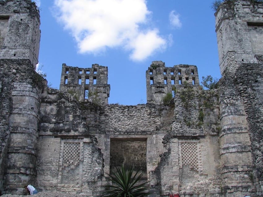
After the second half of the eighth century, some cities experienced a population, construction, and artistic resurgence. The Campeche cities of Xcalumkin and Río Bec stand out as exponents of the Puuc and Río Bec architectural styles, characterized by facade ornamentation, geometric latticework, Chaahk masks, and zoomorphic facades — but these styles also leave evidence of sociopolitical change. At both sites, a new type of government appears to have emerged, not ruled by the k’uhul ajaw (“sacred lords”) of Calakmul and Tikal, but by members of different dynastic lineages.
Further evidence of crisis appears at Oxpemul, 25 kilometers north of Calakmul, where rulers continued erecting monuments into the first half of the ninth century, depicting themselves with the attributes and titles of power that legitimized their status. Their hieroglyphic narratives linked Oxpemul to Calakmul — reinforcing ties of origin while making clear they did not belong to the disgraced Kanu’l dynasty, but to another dynasty bearing a bat-head emblem glyph. This possibly reflects a survival strategy: association with Calakmul still conferred legitimacy, but the Kanu’l name had been indelibly tarnished by their defeat.
Though political weakening led to internal fragmentation across the Maya area, these processes did not unfold in the same way or at the same time everywhere.

Dos Pilas rises and war comes to the Petexbatun
In the Petexbatun region of modern-day Guatemala, the fall of the Kanu’l dynasty meant the rise of Dos Pilas, its former ally. Dos Pilas cemented control of the La Pasión River routes through marriage alliances with the river port city of Cancuén, while a dynastic faction established itself 12 kilometers southeast at Aguateca — a co-capital defined by its strategic location atop a large cliff.
This development sparked confrontations with rival cities Tamarindito and Arroyo de Piedra, whose rulers saw their regional authority threatened. By the end of the eighth century, endemic warfare led to Dos Pilas’s destruction and the relocation of its ruling dynasty to Aguateca, igniting yet more intense conflict among Tamarindito, Aguateca, Ceibal, and La Amelia. In A.D. 810, Aguateca was brutally attacked, burned, sacked, and completely abandoned — researchers have found evidence that residents’ last activities were abruptly interrupted.
Amid the fragmentation, new settlements emerged. Punta de Chimino, protected by its peninsula location and deep defensive ditches, survived into the Terminal Classic period. Ceibal experienced a resurgence around A.D. 830, adopting foreign artistic and architectural styles with influences from central Mexico or the Gulf Coast, suggesting contact with distant cities — but this splendor was brief, and Ceibal was abandoned around A.D. 900, its population likely migrating to the northern Maya Lowlands and Highlands.
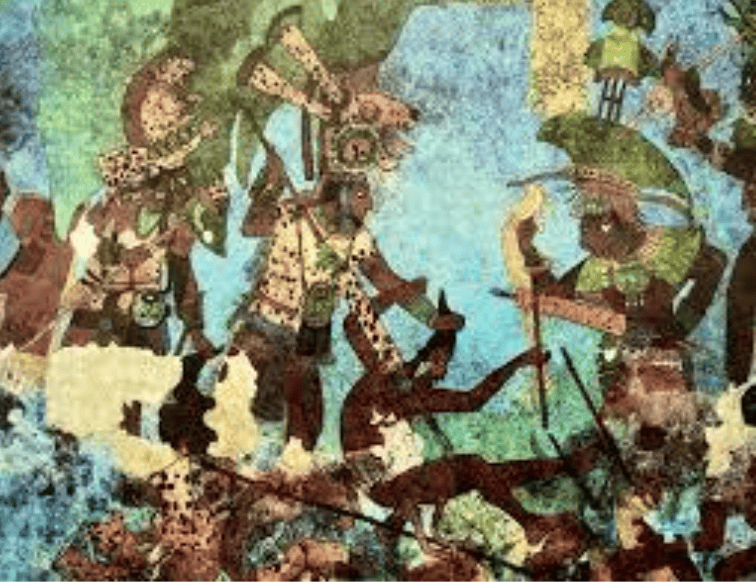
A similar situation unfolded in the Usumacinta region, with escalating conflict between the ruling dynasties of Yaxchilán in Chiapas and Piedras Negras in Petén. Around A.D. 810, Yaxchilán emerged victorious — but apparently only briefly, as no evidence of subsequent construction or new monuments has been found, indicating swift abandonment. Nearby Bonampak, an ally of Yaxchilán, left behind painted murals that vividly illustrate the traumatic regional reality of the period.
Maya cities on the Yucatán flourish
While the Usumacinta and Petexbatún river basins succumbed to catastrophic warfare, the northern Yucatán Peninsula — specifically the Puuc region — flourished. Between A.D. 750 and 1050, urban centers such as Uxmal, Sayil, Labná, and Kabah registered significant population growth, welcoming elites and displaced populations possibly seeking refuge. Regional alliances consolidated power in the Puuc area during the ninth century, with cities like Uxmal and Kabah connected by sacbes (“white roads”) that facilitated trade and interaction. Because the Puuc area lacks rivers, it depended entirely on rainwater collected in chultunes (underground storage pits) and aguadas (reservoirs) — making the climate crises of this period a key driver of eventual urban abandonment.
Further northeast, Ek’ Balam in modern-day Yucatán state stood out as an enclave preserving the traditional structures of the southern Maya Lowlands. Under the rule of Ukit Kan Lek Tok’, Ek’ Balam emerged as one of the peninsula’s hegemonic powers toward the end of the eighth century, its influence extending to the rise of Chichén Itzá, as suggested by the Halakal Lintel inscription found there.
The fall of the Puuc alliances
Growing rivalry with the Puuc entities and the rise of new military powers forced the reinforcement of Ek’ Balam, including the construction of concentric defensive barriers. Meanwhile, a severe water crisis — possibly compounded by soil depletion from overpopulation — collapsed the Puuc regional alliances. The resulting power vacuum was exploited by Chichén Itzá.
Though human occupation of Chichén Itzá dates to the Preclassic period, its construction and population boom began around A.D. 600, when groups arrived from across the Yucatán Peninsula and from as far as central Mexico. Late inscriptions from this period include words from Ch’ol, Tzeltal, Huasteco, Yucatec, and even Nahuatl. From A.D. 1000 onward, Chichén Itzá became the great metropolis of the Maya area, successfully establishing itself within the new political, social, and commercial realities of the Postclassic period.
Pablo Mumary holds a doctorate in Mesoamerican studies from UNAM and currently works at the Center for Maya Studies at IIFL-UNAM as a full-time associate researcher. He specializes in the study of the lordships of the Maya Lowlands of the Classic period.