About 2,088 people in northwestern Ontario remain under evacuation due to wildfires in the region, according to a spokesperson for the province’s minister of emergency preparedness and response.
Meanwhile, some communities are starting to send their members home.
Evacuees from Aroland First Nation and Ojibway of Saugeen First Nation have already returned, while members of Cat Lake First Nation, McDowell Lake First Nation and Mishkeegogamang First Nation are in the process of returning.
“The number of evacuees is reported into the Provincial Emergency Operations Centre (PEOC) by community leadership. Evacuation numbers may fluctuate as community leadership confirm the total number of evacuated community members with the ministry,” wrote spokesperson Julia Facca on Wednesday.
Eabametoong First Nation is planning to start sending evacuees home from Niagara Falls as early as Friday, the community posted on Facebook.
Meanwhile, other communities, such as Gull Bay First Nation, are urging those who have not left the community to do so as quickly as possible.
“I would not ask you to leave your home or our land if it were not truly necessary. But for your own safety, and for the safety of our community and our responders, please leave now,” Gull Bay’s Chief Wilfred King wrote in a community notice on Wednesday.
Active fires in the northwest
There are 117 active wildfires across northwestern Ontario, according to the latest update from Ontario’s Aviation, Forest Fire and Emergency Services (AFFES) issued on Wednesday evening.
Of these, 25 are not under control, five are being held, five are under control and the rest are being observed.
There were 3 new fires confirmed in the northwest on Wednesday evening:
- Dryden 54 (DRY054) is located approximately seven kilometres west of Highway 599 between Paguchi Lake and Victory Lake. The 0.1-hectare fire is being held.
- Kenora 26 (KEN026) is located near the north shore of Clytie Bay in Shoal Lake. The 0.1 hectare fire is not under control.
- Sioux Lookout 105 (SLK105) is located in Lac Seul First Nation, between English River and Upper Grassy Bay. The 0.2 -hectare fire is not under control.
The largest wildfire in the region, known as Thunder Bay 36, remains out of control at almost 314,000 hectares. A NOTAM (Notice to Airmen) is also in effect in the area.
Yellow heat warning
A yellow heat warning from the Manitoba border, south to the Canada-U.S. border and north to Deer Lake has moved east toward Wabakimi Park on Wednesday.
Environment and Climate Change Canada says conditions may continue into Thursday and possibly Friday, with daytime highs of 29 to 31 C, humidex values of 33 to 38, and nighttime lows of 16 to 20 C.
Evacuation, implementation orders
Evacuation orders or alerts remain in effect for areas near the following fires:
Those under evacuation orders are required to leave the area, while those under evacuation alerts are urged to prepare to evacuate.
The Ministry of Natural Resources’ Thunder Bay–Ignace District has invoked implementation orders near the following fires:
- Dryden 34 and 35.
- Fort Frances 14.
- Thunder Bay 36, 54 and 56.
Implementation orders limit people’s ability to travel in and around these fires.
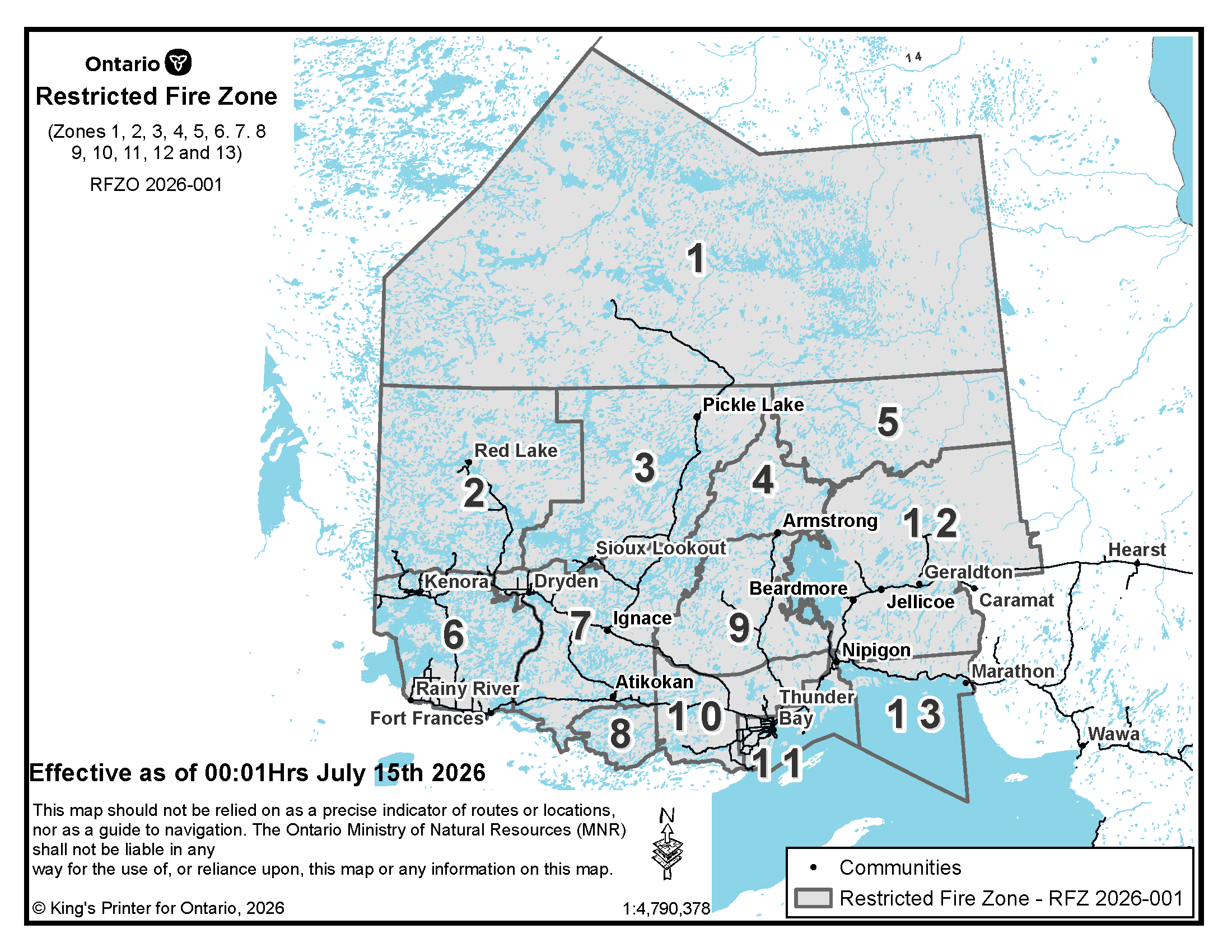
Northwestern Ontario and a small portion of northeastern Ontario remain under a restricted fire zone, which means no open-air burning, including campfires, is allowed.
The forest fire hazard is mostly moderate across the northwest, with pockets of high hazard throughout the Kenora and Thunder Bay districts. A pocket of extreme hazard is also visible near Dryden and Kenora.
Highway closures in effect
According to the province’s interactive highway map, the following roads are closed due to wildfire activity:
- All lanes are closed in both directions on Lac des Mille Lacs Road from Inwood Road to Highway 17.
- Highway 811 is closed, with the exception of local traffic evacuating the area.
- Highway 527 is closed in both directions between Tertiary Highway 811 and Armstrong.
The Ontario Provincial Police (OPP) urge people for their safety and the safety of emergency responders to:
- Stay away from affected areas and refrain from attending wildfire scenes to take photos or videos.
- Remain calm and follow all evacuation orders and emergency instructions issued by local authorities.
- Avoid non-essential travel in affected areas.
- Monitor official sources for the latest information and evacuation updates.
- Remain away from evacuated areas until authorities have advised it is safe to return.
- Help keep roadways clear so emergency personnel can carry out their work safely and effectively.
- If evacuating, bring essential medications, identification, important documents, mobile devices and chargers and any items required to support family members and pets.
Canada Post red delivery service alerts
Mail delivery has been suspended in the following communities due to wildfire activity:
- Cat Lake (evacuation order).
- Gull Bay.
- Armstrong Station (evacuation order).
- Collins (evacuation order).
“Effective July 24, residents and businesses of Aroland (P0T 1B0), Cat Lake (P0V 1J0), Gull Bay (P0T 1P0), Armstrong Station (P0T 1A0) and Collins (P0T 3E0) receive free Mail Forwarding service for up to 12 months. Impacted residents have until Aug. 24 to register for the free service,” Canada Post said.
No new fires in the northeast
Thirteen wildland fires were confirmed in the northeast on Tuesday, according to the latest update from Ontario’s Aviation, Forest Fire and Emergency Services (AFFES) issued on Wednesday evening.
- Sudbury 32 (SUD032)is 0.1 of a hectare and located approximately 2 kilometres southwest of Markstay, and 1 kilometre north of Nepewassi Lake Road. The fire is under control.
- Sudbury 33 (SUD033)is 0.1 of a hectare and located on the south end of Island Lake, approximately 1.75 kilometres east of Wolf Lake. The fire is not under control.
- Sudbury 34 (SUD034)is 5 hectares and located approximately 0.5 of a kilometre southwest of Hider Lake, and 5 kilometres east of Armstrong Lake. The fire is not under control.
- Sudbury 35 (SUD035)is 0.1 of a hectare and located approximately 1 kilometre west of Mozhabong Lake, and 6 kilometres east of Jackson Lake. The fire is not under control.
- Sudbury 36 (SUD036)is 0.5 of a hectare and located approximately 1.4 kilometres northwest of Patsy Lake, and 1.2 kilometres southeast of Plantes Road. The fire is not under control.
- Sudbury 37 (SUD037)is 0.1 hectares and located approximately 1.5 kilometres west of Lac aux Sables, and 3 kilometres southeast of Five Star Lake. The fire is not under control.
- Chapleau 14 (CHA014),Chapleau 15 (CHA015)andChapleau 16 (CHA016)were 0.2, 0.1 and 0.1 of a hectare respectively and located along Melwel Road, next to Red Rock Lake. These fires areout.
- Chapleau 17 (CHA017)was 0.1 of a hectare and located along Melwel Road, approximately 0.5 of a kilometre east of Basswood Lake and 0.5 of a kilometre south of Red Rock Lake. The fire isout.
- Chapleau 18 (CHA018)was 0.1 of a hectare and located along Melwel Road, next to Red Rock Lake, approximately 0.5 of a kilometre east of Basswood Lake. The fire isout.
- Chapleau 19 (CHA019)was 0.1 of a hectare and located along Melwel Road, approximately 0.2 of a kilometre east of Basswood Lake. The fire isout.
- Cochrane 48 (COC048)is 25 hectares and located approximately 27 kilometres south of Fort Albany. The fire is being observed.
There are currently 42 active wildfires in the northeast. Of these, five are not under control, two are being held, two are under control, and the rest are being observed.
Hazard levels range from low to moderate, with areas of high hazard throughout the Sudbury, Algoma and Parry Sound districts, as well as Bruce county. A pocket of extreme hazard is also visible around the Greater Sudbury area.
Outside aid against forest fires
There have been four Ontario Corps partners and 17 Ontario Corps volunteers sent to help. As well, the province said the following equipment/supplies have been provided:
- 312 air purifiers.
- 84 air filters.
- Five air scrubbers.
- 2,640 N-95 masks.
- 4,340 hygiene kits.
- 80 food hampers.
As part of these efforts, Feed Ontario and the Ontario Federation of Indigenous Friendship Centres are shipping and distributing food to evacuees.
In addition, the Kaministiquia and Upsala fire departments were among some regional fire services to receive wildland fire skids from GlobalMedic.

This year’s wildfire season in northwestern Ontario has shone a light on the challenges facing smaller fire departments, as volunteers do what they can with the limited resources at their disposal. Here’s how GlobalMedic is supporting those on the front lines to help them better protect their communities.
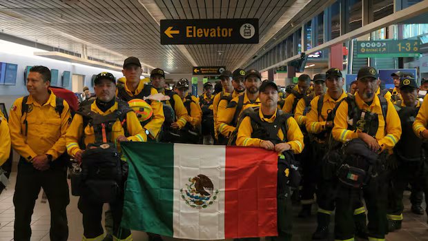
Mexico, Alberta, New Brunswick, Newfoundland, the Yukon, PEI, the Canadian Forest Service and the Canadian Interagency Forest Fire Centre have also offered province-wide assistance.
Thunder Bay transitions to ‘enhanced monitoring’
The City of Thunder Bay moved from active emergency co-ordination to enhanced monitoring.
Residents are encouraged to take steps to reduce wildfire risk around their homes and properties by following FireSmart principles.