
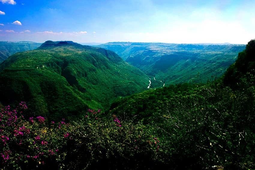
Guadalajara is the perfect location for people looking for a quick escape from noise and congestion on a fine summer day. The city is bordered to the north by gorgeous Oblatos Canyon and to the west by Bosque la Primavera, a magnificent pine and oak forest the size of 42,657 World Cup soccer fields.
Guadalajara also happens to sit at the center of an area where all five of Mexico’s main ecosystems converge. This puts tapatios (Guadalajara residents) within a day’s drive of mountains, beaches, deserts, rivers, slot canyons, hot springs and Mexico’s largest lake.
My wife and I described 90 of these sites in our three-volume series “Outdoors in Western Mexico,” no longer in print but available in digital form.
The importance of finding a good guide
These days, I suggest that hikers contact local guides to arrange for excursions out in the blue. The guides know the territory, the people who live there, the weather patterns and the feasibility of transit on a given day. On top of that, you’ll have a chance to contribute to the local economy.
One of those knowledgeable guides is outdoor enthusiast Mike Gallegos. Mike is the founder of Senderismo Guadalajara, which organizes hikes and climbs all over Western Mexico.
500 meters straight down
As I mentioned above, Guadalajara has some great outdoor sites located immediately adjacent to the city. For example, you can take a bus to Parque Puerta de la Barranca at the northern edge of town for a good look at magnificent, 500-meter-deep Cañon de Oblatos, also called Cañon de Huentitán. Very near the park, there’s a steep trail — once part of the famed Camino Real — which takes you to the Santiago River at the bottom. Here you’ll find graceful Puente de Arcediano, the second suspension bridge built in the Americas.
To get back up to the city, Senderismo Guadalajara offers two unforgettable, adrenaline-raising routes. One is via the Árbol de la Bruja (“Witch’s Tree”), while the other takes you up an abandoned cable-car track. Hang on to your hat!

Hot river, cool forest
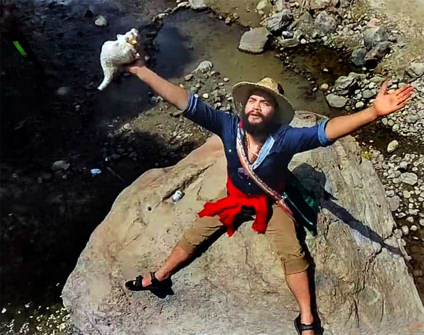
At its Western edge, greater Guadalajara butts up against the Primavera Forest. Here, Senderismo Guadalajara has an exciting hike following the forest’s famed Río Caliente to the bizarre Cascada Esmeralda, which looks cold and alpine from a distance, but turns out to be hot and steamy up close. At its source, this river literally boils its way out of a spot you may be tempted to call the “Gates of Hell.”
For a totally different experience in this forest, you can hike seven kilometers atop mesas covered with pine and oak trees to reach Nejahuete Tower, better known as Torre Dos. Here you can climb up to a platform manned by forest-fire spotters 24 hours a day. The view from this tower is truly breathtaking.
‘The Tooth’
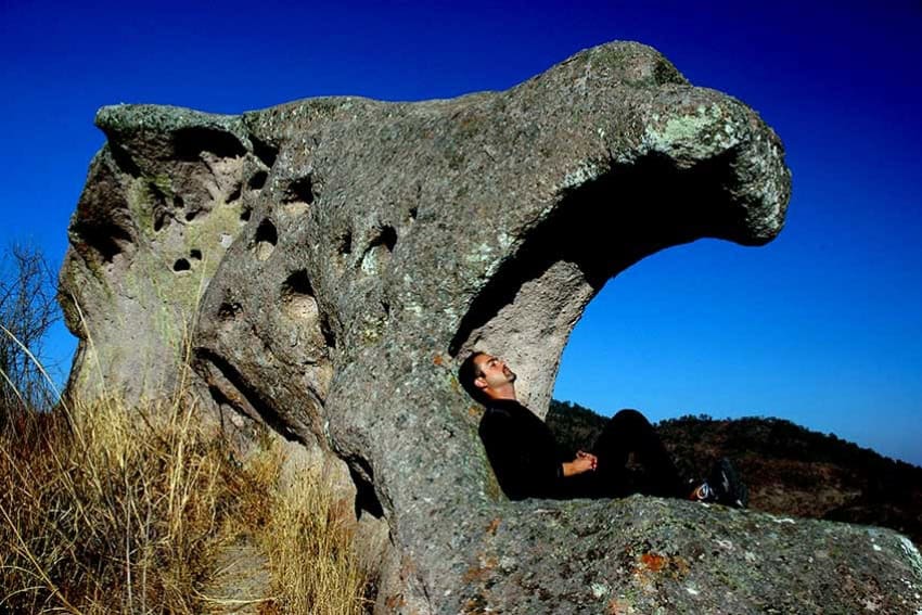
Another outstanding site on Guadalajara’s perimeter is “El Diente,” located only six kilometers north of the City’s busy Periférico or Ring Road. A veritable forest of giant rocks stands here in total silence except for the grunts of rock climbers who consider the monoliths ideal for perfecting their techniques. These hard rocks were once part of the Earth’s mantle and may be 30 million years old. You’ll enjoy taking Senderismo Guadalajara’s six-kilometer loop hike around the mass of monoliths.
Once you drive out of the city, you’ll find great summertime escapes at every turn.
Stargazing on Ceboruco Volcano
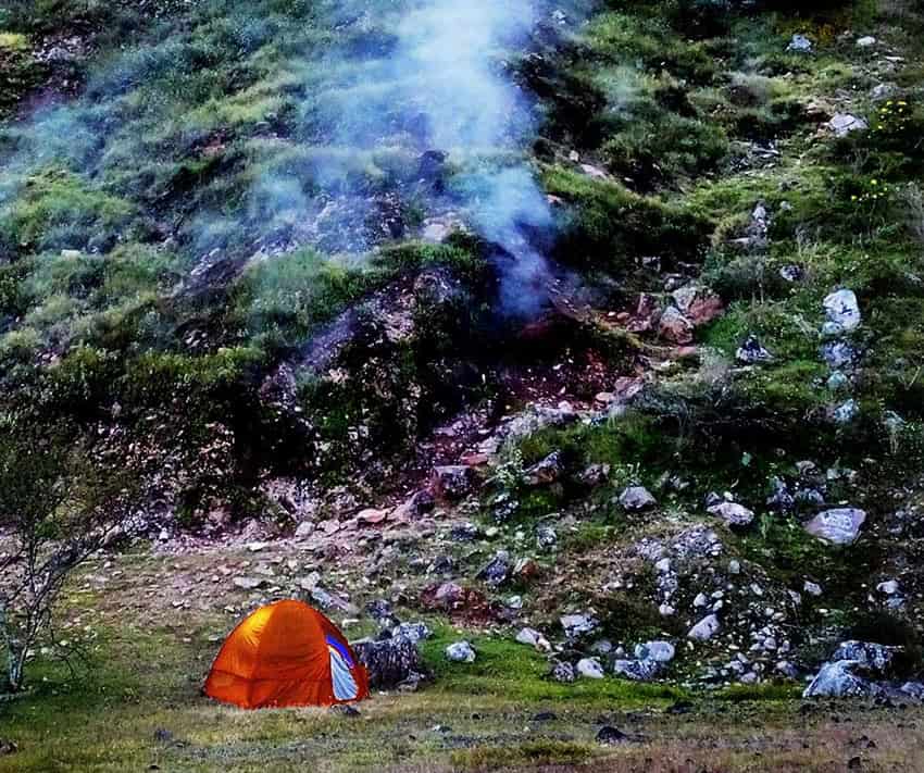
Ceboruco is a massive, still active volcano, 2,280 meters high, in the state of Nayarit, a two-hour drive from Guadalajara. The camino to the top is in good condition — and don’t be surprised if you see road runners along the way.
Senderismo Guadalajara will arrange for you to camp on the flat, grassy floor of an old crater a few meters below a billowing and hissing fumarole, with a spectacular view of the starry sky. The next day, you can hike to another of Ceboruco’s seven craters, from whose rim you can gaze down at a dramatic tongue of lava stretching off into the distance. Those “ants” you see crossing the rubble far, far away are actually buses and semi-trailers!
Comala Falls: Am I in paradise?
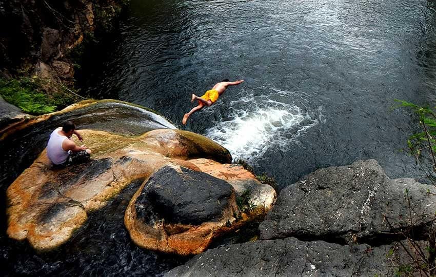
A two-hour drive to the southwest of Guadalajara brings you to the foot of an utterly spectacular waterfall. You can practically jump out of your car and straight into the delightful, bubbling pool at the foot of the cascade. “What more could I ask for?” you say, and Mike Gallegos replies: “More than you would ever believe.”
There are, in fact, 11 more waterfalls upstream. Welcome to paradise!
There are other falls and volcanoes near Guadalajara, too. But in case you get a yen for a jungle experience instead, you might drive to Huilotán Ecological Park, 90 minutes north of town, where you can camp next to spring-fed pools beneath mango and fig trees, your eyes peeled for military macaws flying overhead. Oh, did I mention the 100-meter-tall waterfall and the fish-fry dinner?
14 geysers and a psychedelic bell
Next, for something truly different, I recommend the 14 geysers of Los Patitos River, located 30 kilometers north of Huilotán. Of course, there are hot pools, too, so don’t forget your swimsuit.
Finally, how about a little mountain that stands in a category all its own? La Campana (“The Bell”), located 160 kilometers west of Guadalajara, features giant wave-shaped rock formations that look as if they could have been designed by Antoni Gaudí. Don’t forget your camera!
To start exploring Guadalajara’s natural wonders, contact Mike Gallegos at WhatsApp +52 (331) 136-8254.
John Pint has lived near Guadalajara, Jalisco, for more than 30 years and is the author of “A Guide to West Mexico’s Guachimontones and Surrounding Area” and co-author of “Outdoors in Western Mexico.” More of his writing can be found on his website.
